


Quote
o: Clockwise offset
x: X coordinate
y: Y coordinate
x: X coordinate
y: Y coordinate
Quote
0x59CD00 19047 ORDER COORDINATE: Exactly x + 65536*y
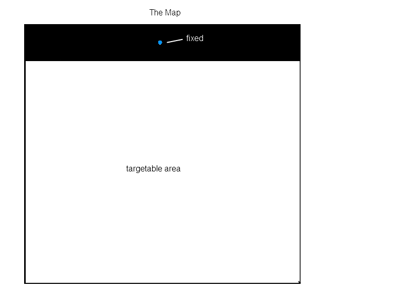
The target x coordinate is practically impossible to obtain from the first address as you need to check within every y-coordinate to get that value; however, it is practical for us to write triggers to obtain the y coordinate simply by brute force.
Target Y coordinate --> counter 1
Quote
0x59CCF0 19043 DIRECTION: AtLeast 16777216*o, AtMost 16777216*o + 16777215
Next we can obtain the direction, once again by brute force, ground units probably won't work because their direction is effected by terrain, other units, and so fourth, as well as their natural tendency to walk straight up and straight down..
Unit direction --> counter 2
Third, we can by some means obtain the units current position, either by EUDs, or by Exact Coordinate Detection
Unit X coordinate --> counter 3
Unit Y coordinate --> counter 4
now we have:
Target Y coordinate
Unit direction
Unit X coordinate
Unit Y coordinate
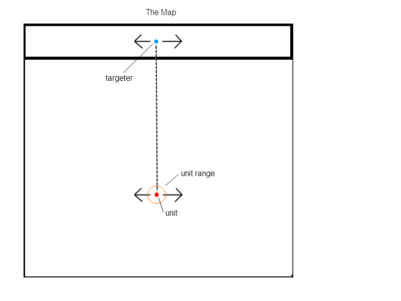
lets set this into a picture:
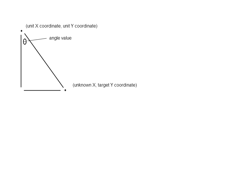
Whoa, it looks like a right triangle has formed!
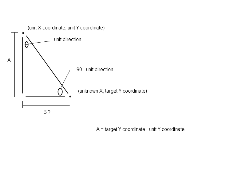
We can do this math...
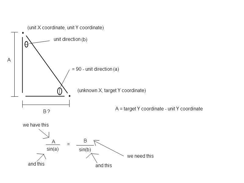
B / Sin(b) = A / Sin(a)
B = A * Sin(b) / Sin(a)
but b = 90 - a
so...
B = A * Sin(90 - a) / Sin(a)
B = A * [ Sin(90-a) / Sin(a) ]
B = A * [ Cos(a) / Sin(a) ]
B = A * [ 1 / Tan(a) ]
B = A * 1 / Tan(a)
B = A / Tan(a)
Target X coordinate = B + unit X coordinate
Target X coordinate = A / Tan(a) + unit X coordinate
This is a totally manageable equation, which I estimate will take around 150 triggers to execute (the whole system will, of course, take many more).
If successful, we could quickly obtain the target coordinates of an air unit, we can then create an effect at the location, perhaps a grenade hit or a masser destination, or just a cool graphics effect through the use of Precise Location Placement.
What also springs to mind is creating dreamlike 3rd-person shooters, advanced combat systems, and new selection systems!
Post has been edited 3 time(s), last time on May 23 2012, 1:02 am by jjf28.
TheNitesWhoSay - Clan Aura - github
Reached the top of StarCraft theory crafting 2:12 AM CST, August 2nd, 2014.
Reached the top of StarCraft theory crafting 2:12 AM CST, August 2nd, 2014.


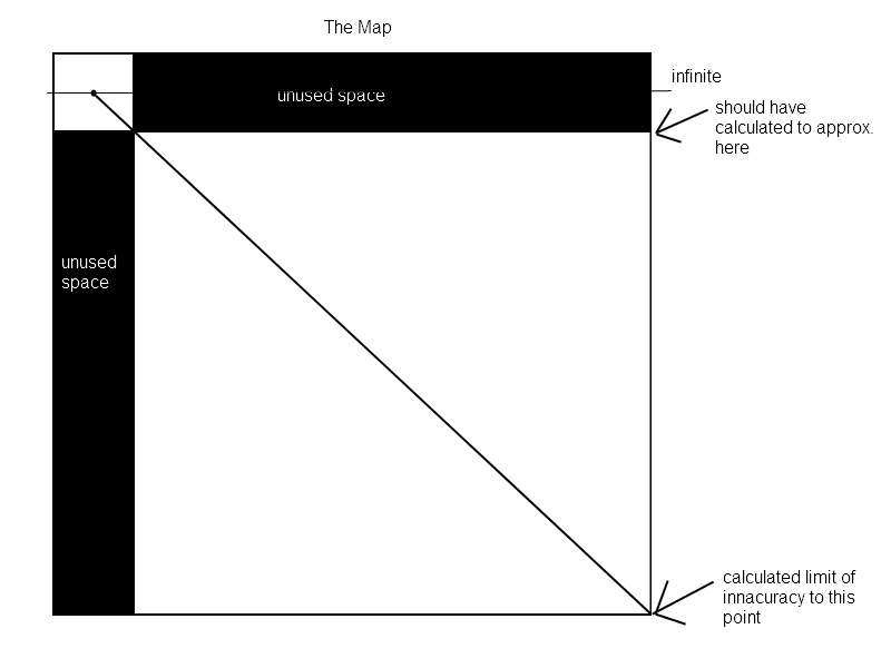
") ) -- average of 1.5 tile inaccuracy at that corner, average of .75 tiles for the whole map -- which wouldn't cut it in a lot of cases - if we have more unique angle values to work with then I think this should work smoothly (assuming my assumption noted above is correct!)
) -- average of 1.5 tile inaccuracy at that corner, average of .75 tiles for the whole map -- which wouldn't cut it in a lot of cases - if we have more unique angle values to work with then I think this should work smoothly (assuming my assumption noted above is correct!)