


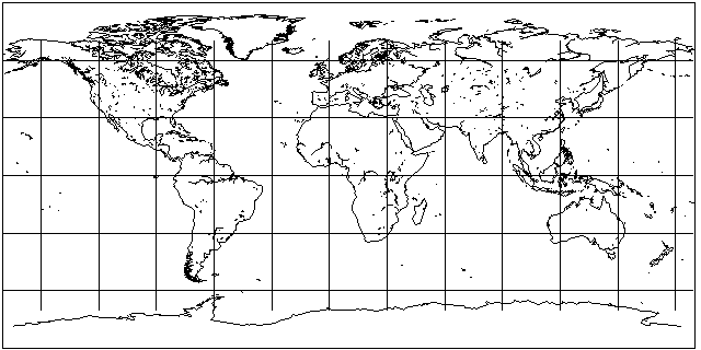
Dimensions: 256 wide 192 height
The Plate Carr�e projection works well with this.
")
Islands that I'd love you to include!
Island name - Pylon Count
Ireland - 2
Great Britain - 5
Cuba - 2
New Zealand - 2/3
Sumatra - 2
Borneo - 2
Phillipines - 2
Formosa(Taiwan) - 1
Japan - 5 (Including Hakkaido and other small surrounding islands)
Maldives - 1
Madagascar - 2
Various Caribbean islands - 2 (Preferably more than 2 islands, though.)
(5 Pacific islands of your choice, preferably Vanuatu, Fiji, Palau, Hawaii, and New Caledonia) - Left side of map, the globe needs to be navigated by a navy. =]
The islands above Canada won't be Pylon-supporting but please do those. :x
Iceland - 1
Hainan - 1
Ceylon (Sri Lanka) - 1
The Continents should be as decourated as you wish, feel free to make America a bit more exotic because it's an Imperialism map. =]
Feel free to include wonders at your leisure.
No buildings, please, just terrain, Sprites would be nice, you can also put down ore deposits where you think they'd be abundant for bonuses.
Anyone else feel free to post extra things I might've left out that would be good.
I'm not a good terrain person and I've tried to terrain, yeah, but... :x
Also, copying terrain from other maps doesn't give me a good bit of originality to work with, that's why I'm asking for someone to try to make a good accurate depiction of the world.
(In addition to adding on to what's good about what I should add and other criteria, give me a good time frame to start off an Imperial-based European map.
 )
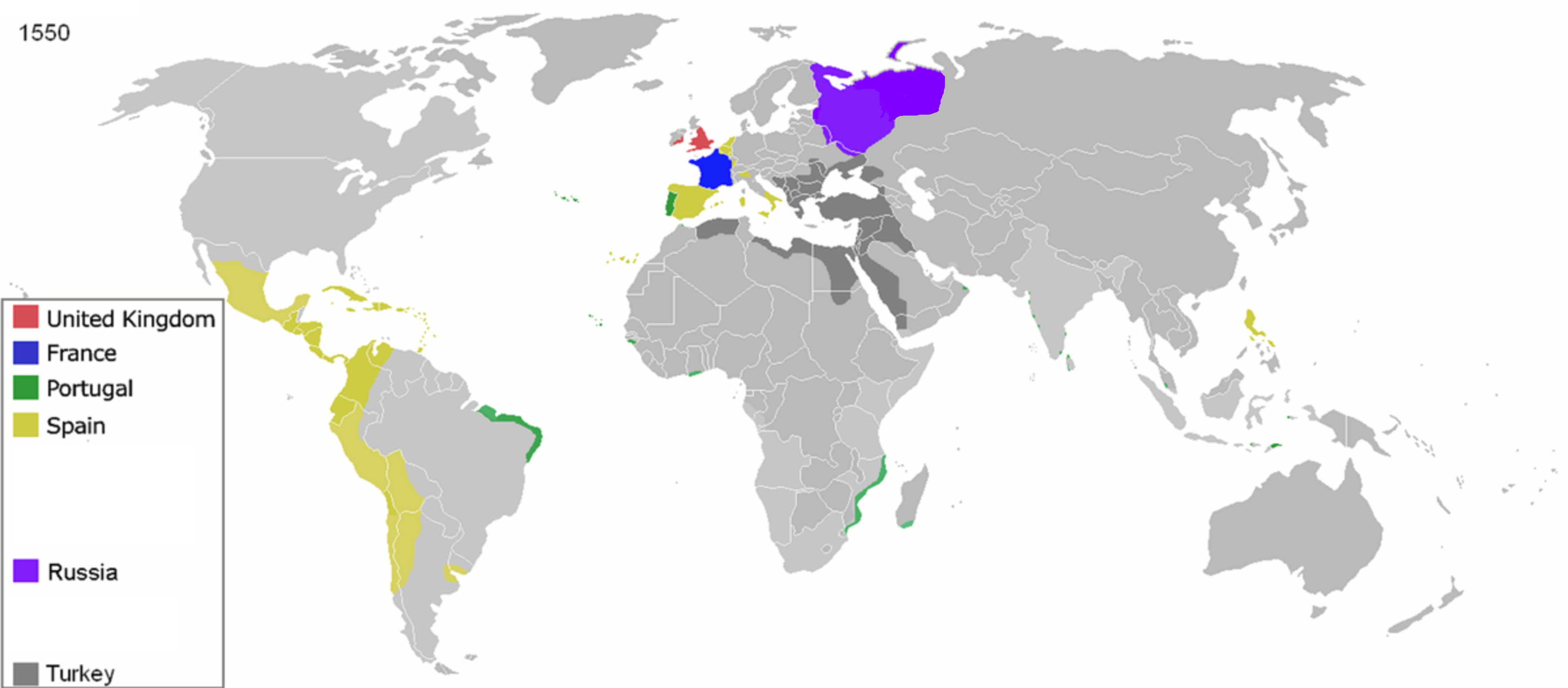
)I suggest 1450 but I think that might be too early. :x
Here's an outline map done to start you off... A basic Image-Map sort of thing. I just need it to look very blended, exotic, etc. =]
Attachments:
Post has been edited 5 time(s), last time on May 13 2012, 2:26 am by JehZirO.
None.